Can the location of a tree tell us whether it is a Big Grove survivor?
This is easy to answer because we know the boundaries of the original Big Grove. The Federal Land Survey between 1804 and 1891 produced Federal Township Plats of all parts of Illinois (available digitally at no cost at http://landplats.ilsos.net/). These maps show the boundaries of timbered areas, as well as prairie and watercourses. The basic grid of black lines on the maps describes 1 mile square "sections" of land, which in rural areas became one or more farms.
Fortunately for historians these section lines also became the real-world location of the "section roads" that cover much of the rural Midwest. So with the help of Photoshop or other imaging software, you can take a digital version of the Survey map for a given area, make the background transparent, and then overlay, rescale, and move it around on a modern digital map, such as a Google map, until the sections are the same size and the watercourses match up.
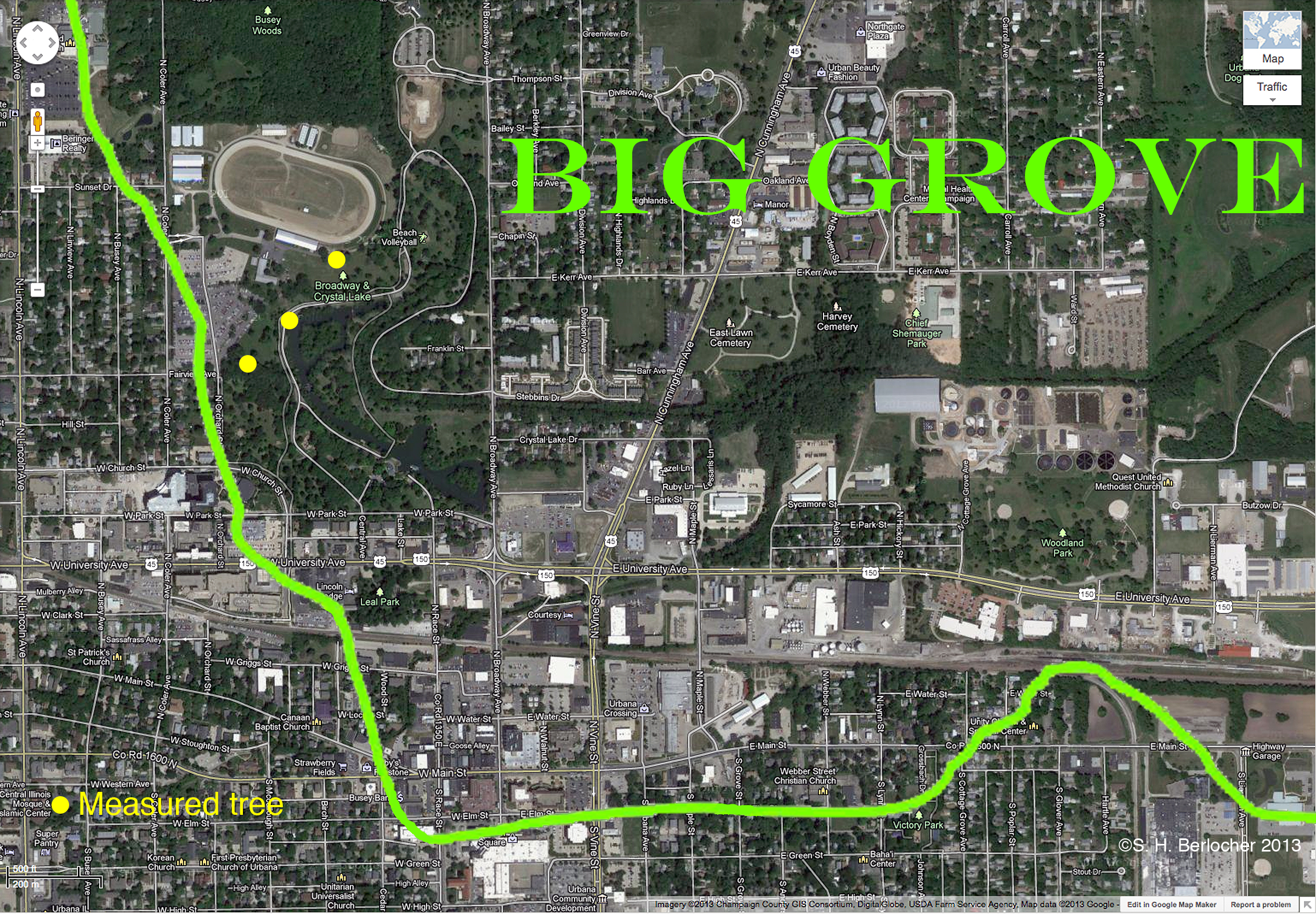
The map below shows the boundaries of the part of the Big Grove in northeastern Urbana, where all three of the trees I have been able to study thus far are located (yellow dots). Everything outside the green line, to the west in Champaign and to the south in Urbana, was treeless prairie. All the trees growing outside the green line were planted at some point from the 1850s on, when most of the construction of the two towns began.
So, the answer to the first question is, "Yes — only trees growing inside the boundaries of the historical Big Grove, as determined from the 1822 Survey maps of Champaign County, can be Big Grove Survivors".